Historical-archaeological research
Amphorae, as an archaeological source, are a key indicator of the distribution of goods, especially bulk goods such as olive oil, wine, and other products. With the help of amphora remains, it is possible not only to trace certain goods, but also to grasp the flow of goods and trade in antiquity. Part of the historical background research of the project therefore deals with the study of amphorae. Thus, the spatial distribution of amphorae as well as their production, transport and use is being researched within the framework of the Dimag Atlas. One focus here is the study of their inscriptions, including the so-called “tituli picti”. This epigraphic information, which goes beyond the typical typological classification of amphorae, is crucial for tracing possible sea routes that connected different regions.


The Torlonia Relief. Image rights: Fondazione Torlonia
A significant part of the historical research on the project involves the study of the written sources of antiquity in order to discuss the framework of Roman maritime trade. The main focus is on the navigational capabilities of ancient seafarers, which they used to orient themselves in the Mediterranean and develop sea routes. Second, it is necessary to discuss the economic factors that influenced actors in their choice of routes. Both the natural and economic conditions are the subject of the description of the Mediterranean world by ancient geographers. Significant information about maritime economies can be gleaned from their works when viewed against the backdrop of documentary sources.
Another research focus of the project is the study of Roman Mediterranean ports. The goal of the analysis here is to work out certain ports of import and export for certain groups of goods and commodities, which have also been proven by researching the written sources, for example in Strabon, and which were accordingly called at for trade in certain goods and thus represent fixed points in the ancient route system. While Rome was known to be supplied with all the goods of the empire, as it were, especially through its ports at Ostia/Portus and Pozzuoli, this is not so clear for the ports in the province of southern Gaul, for example.
Two factors are essential in determining which ports were potential hotspots for which goods: first, it is necessary to identify the goods that have been shown to pass through a port in large quantities, and second, it is necessary to determine whether other infrastructure and conditions may have been required to handle goods at that port and whether they were present.

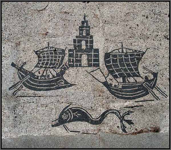
Ostia Antica, Foro delle Corporazioni con pavimento a mosaico, navi e faro
The passage of certain goods can be grasped both through written sources and archaeological findings. The quantity of the throughput can be determined by a similar analysis of the hinterland. For example, it can be shown that although wine was transported in amphorae at almost every port, it must have been handled in much higher quantities at some ports due to a large, well-connected hinterland. If this is basically nothing new for research, however, it also reveals a differentiated picture of the geographical origin of imported wines in the various ports. Likewise, this concerns the local wine export, which (understandably) went through other ports than the import, and whose traces can be traced to India. Based on this data, it is possible to read routes preferred by the trade, always taking into account the prevailing winds and the resulting possibilities or impossibilities of rahbetakel Roman ships.
