Data collection and evaluation
The collection and evaluation of measurement data to determine the performance of ancient sailing ships is a central prerequisite for meaningful route simulations that are as precise as possible – and thus a central goal of the digital atlas. To collect measurement data, researchers from Trier University and Trier University of Applied Sciences have been putting the “Bissula” reconstruction, a 1:1 replica of the Laurons II type, which was funded by the DFG in a previous project and built at Trier University from 2017-2019, through its paces and collecting driving data since 2020.
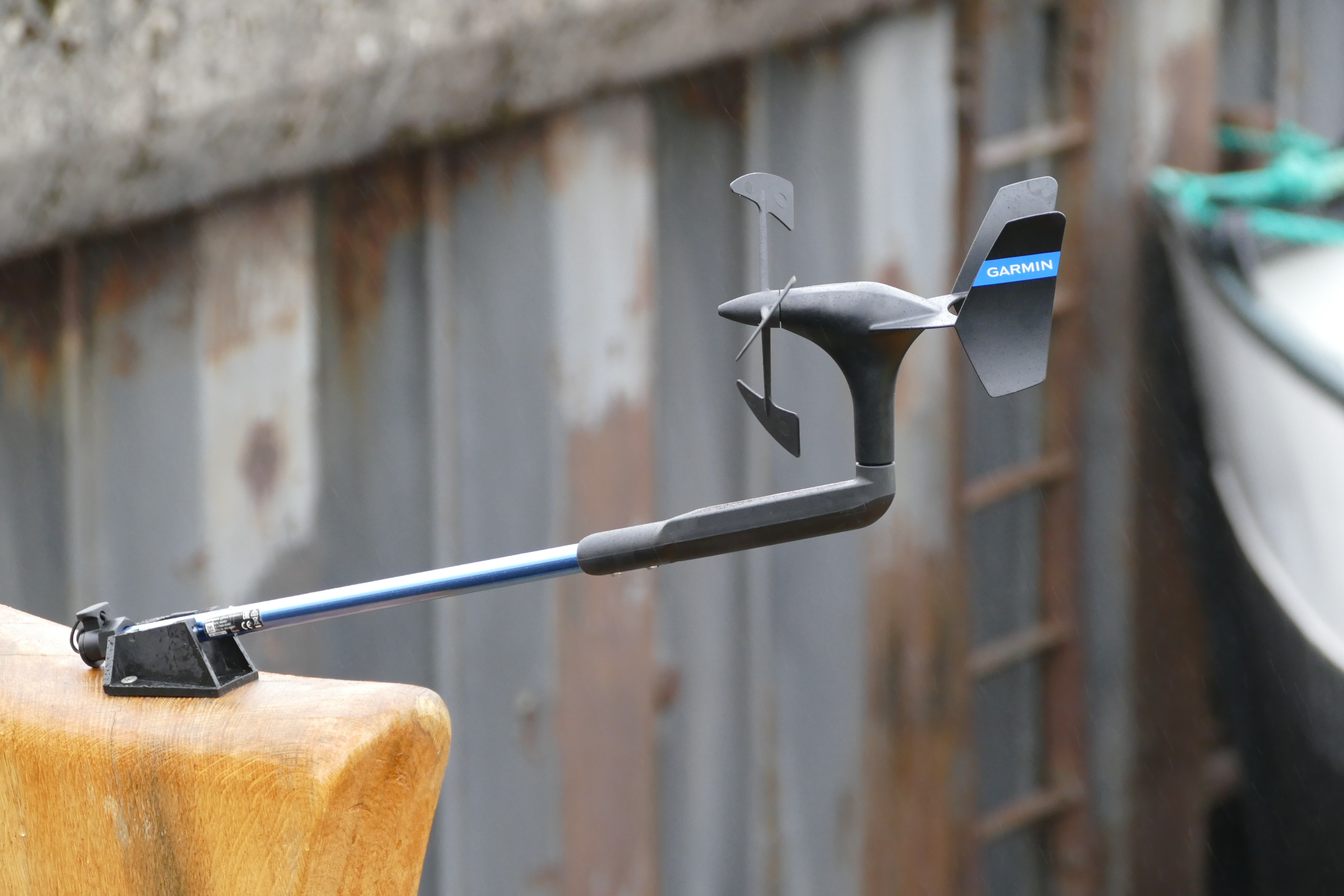
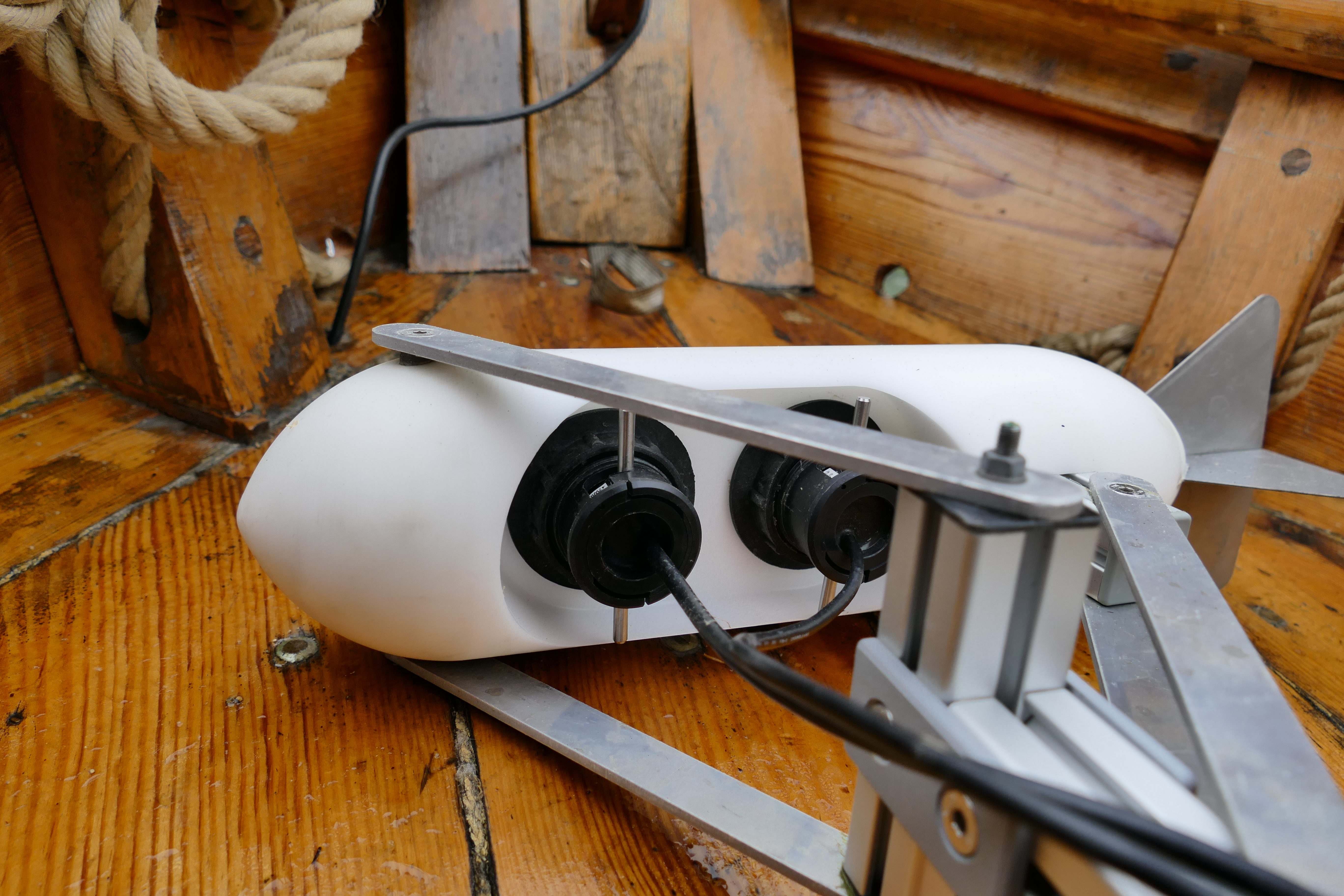
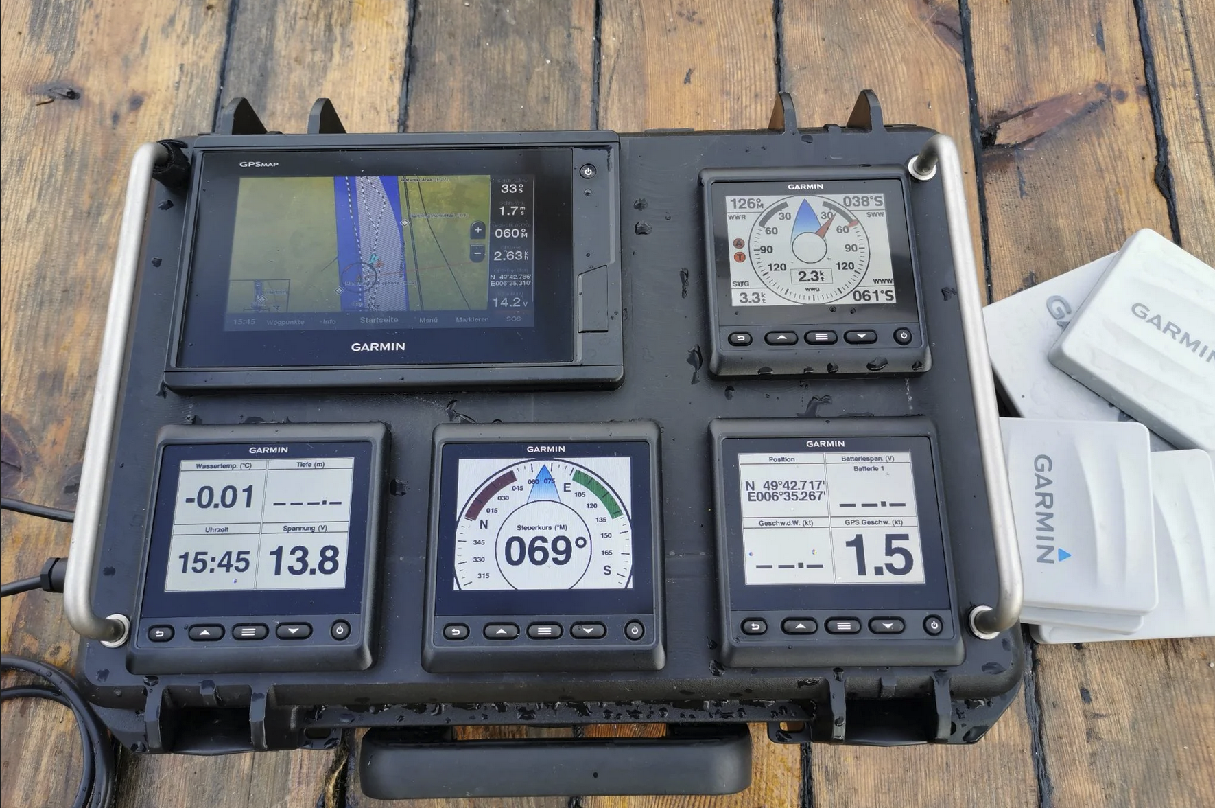
The measuring case shown here represents the core of the measuring electronics. Equipped with modern sensor technology, chart plotter, displays, WLAN receiver and gateways for further analyses and calibrations of the sensors installed on the ship, it measures all the measured values transmitted by the sensors up to ten times per second with the aid of a built-in “black box”. With the help of sensors installed on the vessel, including a GPS module, a log, a depth gauge, a magnetic compass, and a wireless wind meter at the masthead, true and apparent wind speed (AWS and TWS), true and apparent wind angle relative to the vessel (AWA and TWA), GPS speed (SOG), speed through water (BSP and STW, respectively), GPS course (COG), and course by compass (HC) are measured.
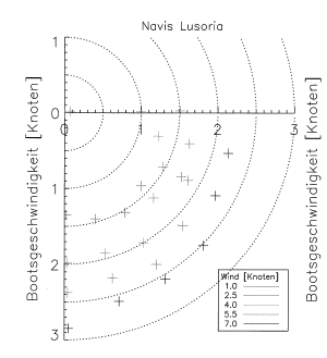
The collected data is then processed and evaluated and results in a so-called polar diagram, which shows the speed of the ship as a function of wind speed and wind angle to the ship. This data is stored in the route simulation software and used for route calculation.